NEWS
Difference between maximum wind speed and maximum wind speed lift rod wind resistance
Time:2021-08-25 View:
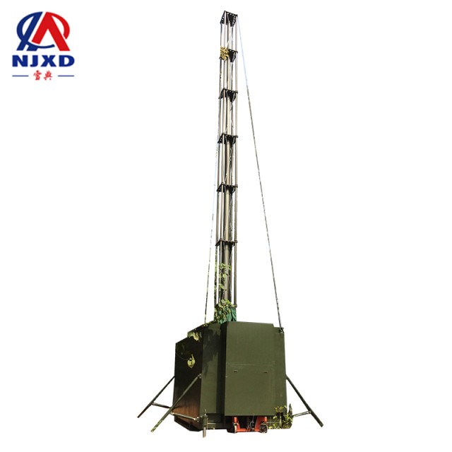
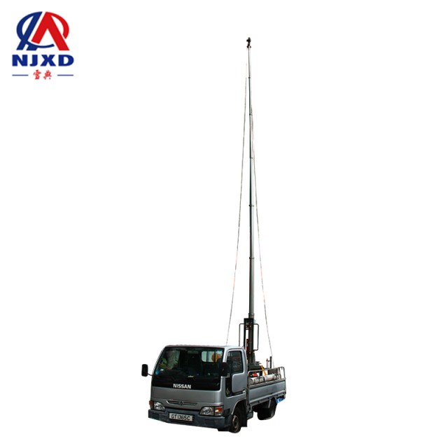
maximum wind speed (maximum wind speed) refers to the maximum 10-minute average wind speed in a given period of time. During the specified period, the maximum wind speed is always greater than or equal to the maximum wind speed. In most cases, the maximum wind speed is greater than the maximum wind speed. It can be used in telescopic mast.
Introduction
maximum wind speed (maximum wind speed) refers to the maximum 10-minute average wind speed in a given period of time. Maximum wind speed refers to the maximum instantaneous wind speed in a given period of time. For example, the maximum wind speed of a day is the maximum wind speed of any 10-minute average value of a day. The maximum wind speed of a day is instantaneous on this day (usually 1s) the maximum value of the wind speed. The simple point is that the maximum wind speed is an average value and the maximum wind speed is an instantaneous value. In the same specified period, the maximum wind speed is always greater than or equal to the maximum wind speed, and in most cases, the maximum wind speed is greater than the maximum wind speed.
Radius
Maximum wind speed radius of tornado
It is very important to understand the maximum wind speed radius of tornado, because the change of air pressure in sealed buildings may lead to structural damage of buildings. Most buildings have a square foot opening every 28 cubic meters of volume to balance the air pressure between the interior and exterior of the structure. The variation range of air pressure is about half of the maximum wind speed radius value, and the maximum wind speed radius of tornado is usually between 46 meters and 150 meters outward from its center or wind eye. One of the widest tornadoes actually measured by radar anemometers appeared in malhall (Mulhall), a small town at the junction of Logan County and Payne County in northern Oklahoma in 1999. A tornado broke out in the state in 1999, its maximum wind speed radius exceeds 800 meters.
Maximum wind speed radius of tropical cyclone
The maximum sustained wind speed of tropical cyclone is the largest, and the smaller the radius of the maximum wind speed is. After observation, it is also confirmed that the most rainfall generated by strong tropical cyclone is usually within the radius of maximum wind speed.
The maximum wind speed radius helps to confirm the location where tropical cyclones will attack directly. If a tropical cyclone is close to the range of land to the maximum wind speed radius, it can be considered that the tropical cyclone has directly attacked the area. The maximum wind speed radius is also used in the calculation formula of the maximum potential intensity of tropical cyclone. This formula relies on the wind speed near the maximum wind speed radius of tropical cyclone to confirm its ultimate potential.
The range of the strongest storm surge generated by tropical cyclones usually coincides with the maximum wind speed radius. Because the strongest wind in the tropical cyclone is within the radius of the maximum wind speed, the HAILANG generated in this area is also the strongest, and HAILANG will eventually drift outward with the center of the storm as the center. Tropical cyclone will mix the sea water within the range of three times the maximum wind radius, and reduce the sea water temperature on the ocean surface due to the effect of upwelling.
Measurement
The maximum wind speed radius is traditionally measured by reconnaissance aircraft. And it can also be determined by measuring the distance between the cyclone center and the maximum pressure gradient of the system on the weather map. Using meteorological satellite data, the maximum wind speed radius can also be measured by measuring the distance between the lowest temperature position of the top cloud layer on the infrared satellite image and the highest temperature part in the wind eye. The feasible principle of this method is that the strongest gas in tropical cyclone is often located in its deepest convection. On infrared satellite images, the deepest convection is also the top cloud with the lowest temperature. In addition, the velocity data of Doppler weather radar can also be used to measure this parameter of tornado and tropical cyclone near the coast.

With extreme wind speed
The daily 10-minute average maximum wind speed and instantaneous maximum wind speed are the projects of ground meteorological observation. Among them, the daily 10-minute average maximum wind speed (also known as the 10-minute maximum wind speed) data are mostly taken from EL-type electric connection wind direction anemograph or EN-type wind data processing instrument; the daily instantaneous maximum wind speed (also known as daily maximum wind speed) data are mostly taken from EN-type wind data processing instrument, or dyin anemometer, or other new wind measuring equipment.
According to the regulations of ground meteorological observation, the average wind speed is actually the average of the instantaneous wind speed in a period of time, and the larger the instantaneous wind speed in a period of time, the greater the average wind speed. Therefore, there is a certain relationship or causal relationship between the average maximum wind speed and the instantaneous maximum wind speed.
Objective methods for evaluating the correctness of the 10-minute average maximum wind speed and maximum wind speed records:
(1) the regression equation and evaluation equation are established with the daily maximum wind speed data as Y and the daily 10-minute maximum wind speed as X. The evaluation equation used for multiple stations (such as effective in entire province) is used for regression analysis with multi-station data. The evaluation equation used for a single station can be used to analyze the data of a single station or similar instrument stations more accurately.
(2) use the evaluation equation to review the accuracy of the data. Put the actual observed maximum wind speed of 10 minutes in the day into the evaluation equation, and compare the calculated Y value estimation with the measured record of daily maximum wind speed. If it exceeds the 95% forecast confidence estimation interval, the maximum wind speed of 10 minutes on the day and the maximum wind speed on the day should be treated as suspicious records, and these two records should be further checked to manually judge whether they are accurate.
(3) write the general evaluation equation into the verification procedure of the Surface Meteorological report, and take the daily maximum wind speed value outside the 95% forecast confidence estimation interval as an indicator to record suspicious and false prompts, realize the objective judgment of the recording accuracy of the maximum wind speed of 10 minutes and the maximum wind speed of the day.
Data Estimation of maximum wind speed or 10-minute maximum wind speed:
(1) the maximum wind speed record of 10 minutes on that day is normal, and the daily maximum wind speed is missing, while in business, service, when the maximum wind speed value needs to be estimated in climate assessment and other work (for example, the daily maximum wind speed value is missing during the typhoon process), the estimated value of daily maximum wind speed value can be obtained through the evaluation equation.
(2) the maximum wind speed of the day is recorded normally and the maximum wind speed of 10 minutes is missing. The maximum wind speed of 10 minutes can also be obtained through the evaluation equation (it is better to re-establish the evaluation equation, the maximum wind speed of 10 minutes is Y, the maximum wind speed is X, and the data of 8 stations are taken for regression analysis, and the regression evaluation equation is obtained as follows: the maximum wind speed is Y = 086+0502±1.50).
CATEGORY
NEWS
- Great wind speed with lift rod wind resistance
- Difference between maximum wind speed and maximum wind speed lift rod wind resistance
- Basic interpretation of Reynolds number lifting bracket wind resistance
- Portable lift rod canvas bag
- Wind energy density grade telescopic mast wind resistance and wind power generation