NEWS
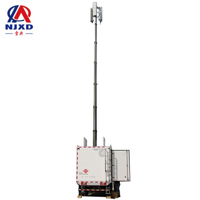
Base station emergency communication radio navigation system
Time:2021-06-25 View:

It refers to the navigation technology that reaches the destination at the specified time. Using the characteristics of radio propagation, the navigation parameters (orientation, distance and speed) of the aircraft can be measured, the deviation from the specified route can be calculated, and the pilot or autopilot can control the aircraft to eliminate the deviation to maintain the correct route.
Introduction
The radio navigation system makes use of the basic principle of radio wave propagation: radio signals propagate at the speed of light in a straight line in free space, as long as the propagation time of radio waves from transmitter to receiver is determined, it can be determined that the distance between the transceiver is the product of the speed of light and the propagation time. Generally, navigation should be completed by the navigation system, including navigation equipment installed on the vector and navigation station installed in other places for use with navigation equipment. Where navigation station and mobile carriers use radio as a medium to realize navigation, it is called radio navigation.
The nature of navigation is determined from the location of navigation station, mainly including land-based navigation system and star-based navigation system.
Land-based navigation system navigation station is located on land, and navigation station is connected with navigation equipment by radio waves, such as very high frequency omnidirectional Beacon (VOR), microwave landing system, Roland and Omega navigation system.
Satellite-based navigation system navigation station is located on artificial satellites, and its coverage is greatly expanded, such as GPS (global positioning system) in the United States and GLONASS in Russia.
Development history
Development History of radio navigation
From the 1920 s to the 1930 s, radiocompas was the only navigation method for navigation and aviation and has been used up to now, but it later became an auxiliary method.
During the Second World War, radio navigation technology developed rapidly, and various navigation systems appeared. Radar also began to be used as navigation means on ships and airplanes, and radar and instrument landing systems began to be used for aircraft landing.
In the 1960 s, astronomical transit satellite navigation system appeared. In the 1970 s, microwave and landing guidance system were successfully developed.
In the 1980 s, the synchronous ranging global positioning system was successfully developed.

Basic principles
Radio navigation mainly uses the basic characteristics of electromagnetic wave propagation: electromagnetic wave propagates along a straight line (or the shortest path) in a uniform ideal medium; The propagation speed of electromagnetic wave in free space is constant; electromagnetic waves will reflect when they encounter obstacles on the propagation route or on the interface of discontinuous media.
Radio navigation uses the above characteristics. Through the reception, transmission and processing of radio waves, navigation equipment can measure the direction, distance, distance difference of the carrier relative to navigation station, navigation parameters such as speed (geometric parameters). By measuring the time, phase, amplitude and frequency parameters of the radio range station transmitted signal (radio electromagnetic wave), geometric parameters such as orientation, distance and distance difference of the motion carrier relative to the navigation station can be determined, so as to determine the relative position relationship between the motion carrier and the navigation platform, and thus realize the positioning and navigation of the motion carrier.
Advantages and disadvantages
Advantages: not limited by time and weather, high precision, far distance, short positioning time, simple and reliable equipment;
Disadvantages: radio waves must be radiated and received, which is easy to be detected and interfered. Navigation station support outside the carrier is required. Once navigation station fails, the corresponding navigation equipment cannot be used; At the same time, it is prone to failure.

Radio navigation system classification
Land-based radio navigation system
Before and after the First World War, it was the invention stage of radio navigation. In 1912, radio compass and Beacon (0.1~1.75MHz) were used for navigation. In 1929, four-channel Beacon (0.2~0.4MHz) was used by aviation. Radio compass and beacon for aviation. It is mainly based on direction finding technology and navigation application, and aviation application will appear later.
1943 years Roland-A(Loran-A) pulse signal, pulse carrier frequency is 2MHz, hyperbolic positioning, the action range is about 400 n mile
1955 Roland-C (Loran-C) pulse signal, pulse carrier frequency is 100kHz, hyperbolic positioning, action range is about 1000 n mile, single positioning accuracy is 460m, repeated positioning accuracy is 18~90m, the data update rate is 10 to 20 times.
1958 Omega continuous wave signal, frequency 10~14kHz, hyperbolic system, penetrating underwater more than 10m, positioning accuracy 2~4 n mile, data update rate 0.1 times/minute, 8 navigation station, global coverage.
1941 instrument landing system (ILS) precision approach radar (PAR)
1942 table card (Decca) continuous wave signal with a frequency of 70~129kHz
1946 VOR very high frequency omnidirectional Beacon, 108~118MHz, continuous wave system, only azimuth, accuracy is about 4~5
Distance measuring device 1949 (DME) short-range aerial navigation system, 960 ~ 1215MHz, only distance, accuracy is about 0.5 n mile
1955 TACAN tactical aerial navigation system, 960 ~ 1215MHz, Pulse system, mainly military (such as airports, aircraft carriers, etc.)
Since the wireless navigation technology was born before and after the First World War, due to military needs, it has developed rapidly in the second world war, and has been further developed and perfected on this basis after the war, and basically formed the current pattern. The wireless navigation system used for navigation is mainly based on hyperbolic positioning system, while the aerial navigation is mainly based on Ranging-direction finding system. Some systems can take into account the needs of navigation and aerial navigation at the same time. Since the 1950 s, various wireless navigation systems have basically completed global coverage. At present, although GPS has been widely used, land-based navigation system is still in use and is still developing.
Satellite radio navigation system
In the 1950 s to 1970 s, the arms race was fierce during the Cold War between the eastern and western camps. The United States and the former Soviet Union in order to meet the actual needs of their own countries and allies in military and aerospace. The political propaganda needs of capitalism camp represented by the United States and the former Soviet Union and the socialist camp respectively.
In 1957, the former Soviet Union successfully launched the first artificial Earth satellite. Satellites began to be used in communication, reconnaissance and other fields, which promoted the development of basic technologies such as technology development, electronic information technology development, time benchmark and transmission, and geodetic mapping.
Astronomical Transit (Transit) is the US Navy navigation satellite System Navy NavigationSatellite System (NNSS), the world's first global satellite positioning System put into use. Transit is mainly designed by Johns Hopkins Applied Physics Laboratory(JHAPL) and funded by the Advanced Research ProjectsAgency (ARPA). The main purpose is to provide global navigation positioning for submarines and surface ships. It was developed in 1958, put into use in 1964, started civil use in 1964, and launched the last satellite in 1988. After 32 years of continuous operation, the mission ended Transit at the end of 1996. At the same time, it opened the prelude of the era of satellite positioning.
In the 1970 s and 1980 s, a global positioning system developed by the U.S. Department of Defense and controlled by the U.S. military was a satellite-based radio fix system composed of 24 artificial Earth satellites, ground control systems and user equipment, that is, GPS. GPS function: provide users with real-time, continuous and high-precision three-dimensional position, speed and time information (PVT) anywhere in the world and under any meteorological conditions. Meaning of GPS:
(1) the contradiction between the coverage and positioning accuracy of the wireless positioning system is solved.
(2) in addition to the military of the United States and its allies, it can also be used by all countries in the world.

CATEGORY
NEWS
- Antenna jacking system microwave station communication equipment
- Base station emergency communication radio navigation system
- Working Principle of radio navigation system base station lifting antenna
- Application and analysis of lifting monitoring in digital oilfield
- Importance of Application survey of lifting monitoring equipment